Environment
The Sediment That Never Arrived
A dam keeps more than water. Downstream coasts and deltas can starve on a schedule
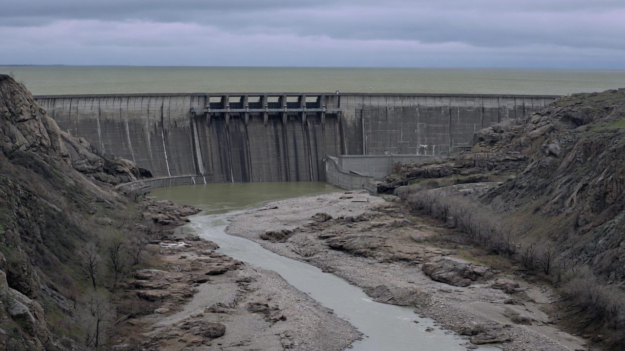
Concrete is very good at stopping water. It is accidentally excellent at stopping land.
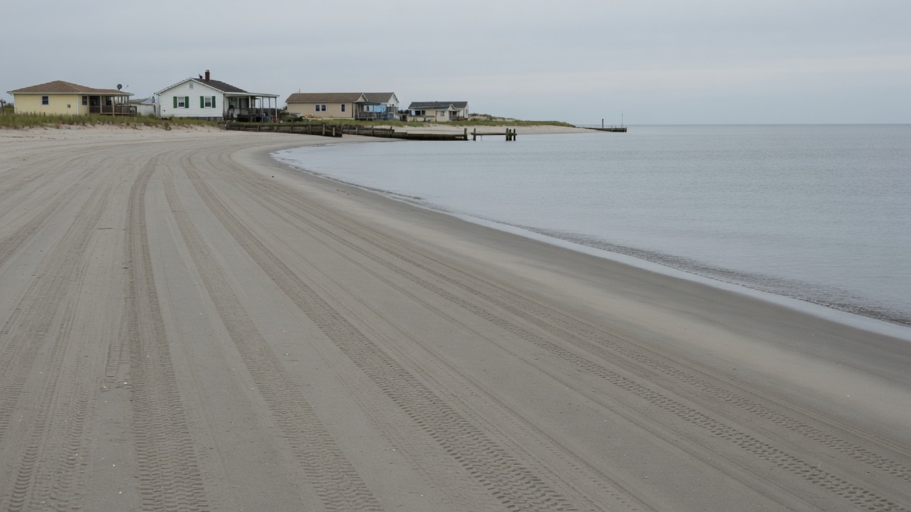
A river is a conveyor of gravel, silt, and sand as well as a conveyor of water. Before a dam, that conveyor fed floodplains, marshes, beaches, and the sea’s edge. After a dam, much of the load settles in the reservoir. Downstream, the water still arrives—often clearer, hungrier, ready to pick up a bed that is no longer being replenished. Channels incise. Deltas subside relative to a rising sea. Beaches thin. We call the result coastal erosion, as if the ocean had simply become ruder.
Geomorphology does not treat this as a parable. It is a mass-balance problem. The hidden force is the dam’s second job, the one not on the visitor-center plaque: trapping the land the river was trying to deliver. Hydropower, flood control, irrigation, and navigation stay in the frame. They are why the concrete was poured. They do not cancel the mud that never arrived.
A global interception
Charles Vörösmarty and colleagues, writing in Global and Planetary Change in 2003, estimated the potential impact of registered river impoundments on sediment transport to the ocean. More than forty percent of global river discharge is intercepted locally by large reservoirs. A significant share of that discharge—about seventy percent in their accounting—has a theoretical trapping efficiency above fifty percent; half of the discharge entering large reservoirs shows local trapping of eighty percent or more. Considering regulated and unregulated basins together, they placed the interception of global sediment flux by registered reservoirs at four to five gigatonnes a year, or about twenty-five to thirty percent of the total.
James Syvitski and colleagues, in Science in 2005, closed a related ledger. Humans have increased the sediment transport of global rivers through soil erosion—by about 2.3 billion metric tons a year—yet reduced the flux reaching the coasts by about 1.4 billion metric tons a year because of retention in reservoirs. More than 100 billion metric tons of sediment, and one to three billion metric tons of carbon, sat in reservoirs built largely in the previous half-century. African and Asian rivers, they noted, carry a greatly reduced load to the sea.
Four years later, in Nature Geoscience, Syvitski, Albert Kettner, Irina Overeem, and coauthors assessed thirty-three deltas chosen to represent the world’s deltas. The vulnerability they described was a stack: sediment compaction from the removal of oil, gas, and water; trapping of sediment in upstream reservoirs; floodplain engineering that whisks remaining sediment out to deep water; and rising global sea level. In the previous decade, eighty-five percent of those deltas had experienced severe flooding, temporarily submerging some 260,000 square kilometres. They estimated, conservatively, that the delta area vulnerable to flooding could increase by fifty percent under then-current twenty-first-century sea-level projections. Most of the deltas in their table were sinking at rates many times faster than global sea level was rising. The Nile and the Colorado appeared in the worst category: virtually no aggradation, or very high accelerated compaction. The Mekong and the Mississippi sat in the category of reduced aggradation plus accelerated compaction overwhelming global sea-level rise.
Sea-level rise makes the missing mud more obvious. It did not invent the trap.
The Nile after Aswan
The Nile built its delta with an annual flood that was also an annual delivery of silt. A series of dams, beginning with the Aswan Low Dam around the turn of the twentieth century and culminating in the Aswan High Dam in the 1960s, stopped almost all of that delivery. Vörösmarty, Syvitski, and John Milliman have all placed Nile trapping near complete. Scott Nixon estimated on the order of ten million tonnes a year of fine sediment no longer reaching the southeastern Mediterranean. Suspended load at stations such as El Gaafra fell from well over a hundred million tonnes a year before the High Dam to a few million afterwards; peak concentrations dropped from thousands of parts per million to tens.
The water stored in Lake Nasser is irrigation, hydropower, and a flood that Egypt no longer has to survive. Those are not small goods. The downstream water, stripped of its load, scoured the bed and banks. The delta, no longer receiving its rebuilding gift, has been retreating under waves, subsidence, and a starved sediment budget. Coastal surveys by Omran Frihy and others documented accelerated erosion on the Rosetta and Damietta promontories after the High Dam, with retreat rates in places of tens to more than a hundred metres a year depending on the interval and the headland. NASA’s later satellite comparisons show a delta edge that has continued to lose land. The dam did what it was asked to do with water. The land was not in the request.
The Mississippi’s other engineering
The Mississippi River Basin, before major engineering, delivered on the order of 400 million metric tons of sediment a year, in a USGS synthesis by Robert Meade, John Moody, and later reviews. Construction of large main-channel reservoirs on the Missouri and Arkansas, sedimentation in dike fields, and bank revetments reduced the overall sediment yield of the basin by more than sixty percent. The river that reaches southern Louisiana is not the river that built southern Louisiana.
The delta plain is a stack of abandoned and active complexes. Brady Couvillion and USGS colleagues, mapping land and water from 1932 to 2016, found a net loss of about 4,833 square kilometres of coastal land in Louisiana—roughly a quarter of the 1932 land area—with rates that varied by decade rather than holding to a single slope. Torbjörn Törnqvist and colleagues have placed the same crisis in a longer stack of subsidence, reduced overbank mud, and a rising sea. One primary mechanism on the modern Plaquemines–Balize lobe is the disconnection of the river from its delta by levees that prevent overbank flooding and the replenishment of the marsh. Dams upstream reduced the supply. Levees decided where the remaining supply was allowed to go: mostly past the wetlands, into deep water. Extraction of oil, gas, and groundwater added compaction.
A 2023 modelling study of Barataria Basin, published in Nature Sustainability, tried to separate the contributions. Before interference, the basin had a sediment surplus. Dam building in the basin decreased overbank deposition by about a third, yet a surplus persisted. Flood-protection levees eliminated overbank deposition and created a deficit, with land loss on the order of 7 square kilometres a year in that accounting. At its peak, subsurface resource extraction roughly doubled the loss rate. The authors argued that dams were secondary to levees and extraction in that basin—an important local finding, not a global pardon for reservoirs. It is a reminder that “sediment starvation” is a family of interruptions: the dam, the levee, the canal, the well. The Mississippi is all of them at once.
Restoration now includes sediment diversions, which are an attempt to put some of the conveyor back onto the marsh without taking the flood-protection levee down. Whether a diversion can keep up with subsidence and sea-level rise on a human deadline is an open engineering question. That the marsh was built by overbank mud is not.
The Mekong’s approaching arithmetic
The Mekong Delta was built, over thousands of years, by a large sediment supply. G. Mathias Kondolf and colleagues, in Water Resources Research in 2014, applied a trapping model to the cascade of dams then built, under construction, or planned. Under a “definite future” of thirty-eight dams already built or under construction, they estimated a fifty-one percent reduction in sediment reaching the delta. Under full build-out of planned dams, cumulative trapping rose to ninety-six percent: once in-channel stored sediment was exhausted, only about four percent of the predam load would be expected to arrive. The paper’s warning was morphological as well as ecological. A delta that does not receive mud cannot keep its surface above a rising sea.
Later work has not been kinder. Observed loads in the Lower Mekong have already fallen sharply since the 1990s as Chinese mainstream dams and tributary projects came online. A 2024 Science Advances paper by Samuel Chua, Kondolf, and others asked whether sluicing sediment through a mega-dam cascade could restore the delta’s budget. Even under an optimistic sluicing scenario, the load at the delta recovered only to about 62 million tonnes, short of a historical range they placed at 100 to 160 million. Unless retrofitted to reroute sediment, they argued, the dams would keep trapping for at least 170 years. Groundwater pumping in the delta and sand mining in the channel add their own deficits. The hydropower is real. So is the arithmetic of a landform that was a gift of the river.
A river that no longer finishes
The Colorado River’s delta, in Mexico, is the American West’s exhibit of a conveyor turned off. Hoover Dam, Glen Canyon Dam, and the rest of the basin’s plumbing store water for cities and farms that would not exist at their present scale without them. Morelos Dam, on the border, diverts what remains into the Mexicali Valley. For years at a stretch, the river did not reach the Gulf of California.
In March 2014, under Minute 319 of the 1944 United States–Mexico water treaty, a pulse flow of about 105,000 acre-feet was released past Morelos Dam into the dry bed. It was the first flow to reach the sea in nearly two decades, and small next to the spring floods of a century earlier. Peak discharge at the dam was about 120 cubic metres a second; infiltration ate most of it. USGS and Mexican colleagues measured new bars, local scour, and suspended sediment in the limitrophe reach. Most of the water became groundwater within weeks. The pulse was a diplomatic and ecological event. It was not a restoration of the sediment budget that built the delta. Hydropower and irrigation remain the basin’s first purposes. The mud that used to fan into the Gulf is in Lake Powell and Lake Mead, or in the fields, or still in the plateaus that no longer see a flood.
When the trap is opened
Dam removal is not a philosophy. It is a sediment experiment with a measured pulse.
The Elwha River, on the Olympic Peninsula of Washington, held two hydropower dams for nearly a century. Together they impounded about 21 million cubic metres of sediment—on the order of 30 million tonnes in later mass estimates. Removal began in 2011 and finished in 2014, the largest dam-removal project in the United States at the time. The Lower Elwha Klallam Tribe’s fisheries and a river that salmon could not pass were the reasons the concrete came down. Power was the reason it had gone up.
USGS gauging in the first two years measured on the order of 8.2 million tonnes of sediment transported downstream, many times the river’s estimated natural annual load of about 340,000 tonnes. Concentrations spiked; the channel aggraded on the order of a metre, filled pools, and braided. Amy East and colleagues found that two years in, about 1.2 million tonnes—roughly ten percent of what had been released from the reservoirs—was stored along the mainstem and floodplain channels. The river delivered most of the rest to the mouth. Jonathan Warrick and colleagues, after five years, estimated that about sixty-five percent of the impounded sediment had been eroded, of which about ten percent deposited in the fluvial system and about ninety percent reached the coast, building on the order of 60 hectares of delta. Many geomorphic signals peaked one to two years after removal began. The river adjusted faster than some of the forecasts.
That pulse is the inverse of the Nile’s silence: land, arriving all at once, because the trap was dismantled. It is also a reminder of cost. Two working dams ceased to make electricity. A river ran dirty for years. Salmon have been returning upstream of the old sites; the sediment and wood have changed spawning gravel and estuarine habitat in ways that are still being counted. Elwha is not a template for Aswan or for the Mekong cascade. It is proof that the conveyor, if reconnected, still knows how to move.
Keep the turbine in the sentence
A serious magazine will not pretend that a dam is only a sediment crime. Hydropower is dispatchable low-carbon electricity in many grids that do not have a surplus of it. Reservoirs hold irrigation through dry seasons and blunt floods that used to kill. The Aswan High Dam’s power station and the water in Lake Nasser are why the dam remains, decades after the coastal erosion became a literature. The Missouri River mainstem dams still make power and still hold the mud that used to feed Louisiana. The Mekong dams are national energy policy in China, Laos, and their neighbors.
The editorial task is to keep both ledgers open. Sediment is a public good that was never priced into the turbine. Sea-level rise is a multiplier on a deficit that dams and levees already opened. Bypass tunnels, sluicing, dam reoperation, and selective removal are the available tools, each with a cost to power, to water supply, or to the people who live in the reservoir’s drawdown zone. None of them is a moral eraser. All of them are admissions that concrete stopped more than water.
Follow the connection far enough and a beach is sometimes a river story, and a sinking farm on a delta is sometimes a reservoir a thousand kilometres upstream. You don’t have to hate the hydropower to read the receipt. The receipt is the land that never arrived.
Sources
- Vörösmarty, Charles J., et al. “Anthropogenic Sediment Retention: Major Global Impact from Registered River Impoundments.” Global and Planetary Change 39, nos. 1–2 (2003): 169–190.
- Syvitski, James P. M., et al. “Impact of Humans on the Flux of Terrestrial Sediment to the Global Coastal Ocean.” Science 308, no. 5720 (2005): 376–380.
- Syvitski, James P. M., Albert J. Kettner, Irina Overeem, et al. “Sinking Deltas Due to Human Activities.” Nature Geoscience 2 (2009): 681–686.
- Milliman, John D., and Katherine L. Farnsworth. River Discharge to the Coastal Ocean: A Global Synthesis. Cambridge: Cambridge University Press, 2011.
- Nixon, Scott W. “Replacing the Nile: Are Anthropogenic Nutrients Providing the Fertility Once Supplied by the River?” Ambio 32, no. 1 (2003): 30–39.
- Frihy, Omran E., and Paul D. Komar. “Patterns of Beach-Sand Sorting and Shoreline Erosion on the Nile Delta.” Journal of Coastal Research 7, no. 2 (1991): 139–150.
- Frihy, O. E. “Nile Delta Shoreline Changes: Aerial Photographic Study of a 28-Year Period.” Journal of Coastal Research 4, no. 4 (1988): 597–606.
- Meade, Robert H., and John A. Moody. “Causes for the Decline of Suspended-Sediment Discharge in the Mississippi River System, 1940–2007.” Hydrological Processes 24, no. 1 (2010): 35–49.
- Alexander, Jason S., Richard C. Wilson, and W. Reed Green. A Brief History and Summary of the Effects of River Engineering and Dams on the Mississippi River System and Delta. U.S. Geological Survey Circular 1375, 2012.
- Couvillion, Brady R., Holly Beck, Donald R. Schoolmaster, and Michelle Fischer. Land Area Change in Coastal Louisiana (1932 to 2016). U.S. Geological Survey Scientific Investigations Map 3381, 2017.
- Törnqvist, Torbjörn E., et al. “Land Loss in the Mississippi River Delta: Role of Subsidence, Global Sea-Level Rise, and Coupled Atmospheric and Oceanographic Processes.” Global and Planetary Change 222 (2023): 104058.
- Edmonds, Douglas A., Stephan C. Toby, Christopher G. Siverd, Robert Twilley, Samuel J. Bentley, Scott Hagen, and Kehui Xu. “Land Loss Due to Human-Altered Sediment Budget in the Mississippi River Delta.” Nature Sustainability 6 (2023): 644–651.
- Kondolf, G. Mathias, Zhongyuan Chen, et al. “Dams on the Mekong: Cumulative Sediment Starvation.” Water Resources Research 50, no. 6 (2014): 5158–5169.
- Chua, Samuel De Xun, Yuheng Yang, G. Mathias Kondolf, et al. “Can Restoring Water and Sediment Fluxes across a Mega-Dam Cascade Alleviate a Sinking River Delta?” Science Advances 10 (2024): eadn9731.
- Mueller, Erich R., Paul E. Grams, John C. Schmidt, and David J. Topping. “Geomorphic Change in the Limitrophe Reach of the Colorado River in Response to the 2014 Delta Pulse Flow, United States and Mexico.” USGS conference paper and related Ecological Engineering reporting on the Minute 319 pulse, 2015.
- Kendy, Eloise, Karl W. Flessa, Karen J. Schlatter, et al. “Leveraging Environmental Flows to Reform Water Management Policy: Lessons Learned from the 2014 Colorado River Delta Pulse Flow.” Ecological Engineering 106 (2017): 683–694.
- East, Amy E., et al. “Large-Scale Dam Removal on the Elwha River, Washington, USA: River Channel and Floodplain Geomorphic Change.” Geomorphology 228 (2015): 765–786.
- Magirl, Christopher S., et al. “Large-Scale Dam Removal on the Elwha River, Washington, USA: Fluvial Sediment Load.” Geomorphology 246 (2015): 669–686.
- Warrick, Jonathan A., et al. “Morphodynamic Evolution Following Sediment Release from the World’s Largest Dam Removal.” Scientific Reports 8 (2018): 13279.
- Randle, Timothy J., et al. “Large-Scale Dam Removal on the Elwha River, Washington, USA: Source-to-Sink Sediment Budget and Synthesis.” Geomorphology 246 (2015): 729–750.
- USGS and Lower Elwha Klallam Tribe. “Science Partnership… Understanding the Elwha River Dam Removal Project.” Fact Sheet 2018–3025.
Concrete is very good at stopping water. It is accidentally excellent at stopping land.
Follow the connection
- Erosion upstream
- River sediment
- Dam
- Trapped mud
- Starved delta or beach
What we know
- Rivers carry sediment as well as water. Deltas, barrier islands, and some beaches are rebuilt by that supply.
- Dams trap a large fraction of incoming sediment in many basins; downstream channels can incise, and coasts can erode faster than they are fed.
- Dredging, levees, and reduced floods compound the starvation.
- Some dam-removal and sediment-bypass projects aim to put the conveyor back on.
What remains uncertain
- How much of a particular beach’s retreat is sediment starvation versus sea-level rise, storms, or nearby structures.
- Whether bypass or removal can restore a given delta on a human deadline.
- The trade-off with hydropower, water storage, and flood control that the dam still provides.
What can we do?
You don't have to care about this because everyone else does. You can care because the evidence gives you a reason to.
- When a coast is “disappearing,” ask whether the river is still allowed to deliver land.
- Support dam operations and removals that treat sediment as a public good, not only as silt in a turbine.
- Keep hydropower’s benefits in the same frame as the missing mud.
Demonstration authors are fictional. The phenomena discussed are real subjects of public scientific literature and reporting. Sources named in the article are documented; this is not a comprehensive literature review.